Trimble Marine Solutions
You face any number of challenges in marine construction. Tidal height variations, currents, distance from land and a work area that you can’t always see. Your ability to position a structure, vessel or dredge head can be compromised by everything from water depth to working at night or in foggy conditions.
Trimble offers a range of high-precision centimeter level (RTK) positioning as well as sub-meter (DGPS) positioning solutions which can be integrated with other marine sensors. SITECH also supports HYDROpro™ Construction and the Terramodel® HDMS to create application specific marine systems.
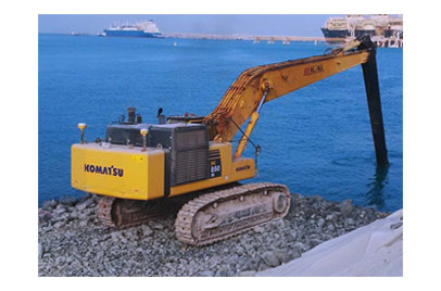
Excavators
Fully submersible excavators controlled either by GPS or Total Stations allows you to quickly complete projects with far less assistance from divers and surveyors. The AS456 sensor has a water tight seal around the angle sensor, allowing the machine to be used for wet construction. With accurate, 3D positioning of the bucket, the system guides the operator to quickly perform complex tasks. The sensor can work in saltwater conditions up to a depth of 20 meters.
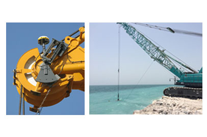
Cranes
The Trimble solution for 3D machine control for wire cranes is a solution which allows the operator to see the location of the grab or hook with cm. accuracy.
SITECH Gulf provides a combination of the best hardware on the market with unique and stable software that provides a solution that can be adapted to any type of wire crane.

Barge
Positioning of pontoons and barges is challenging. Trimble's solutions are known for high stability, reliability and at the same time able to provide a constant flow of data from DGPS or RTK signals. With Trimble RTK GPS Receivers you can monitor the positioning, heading, roll and pitch motions of the barge down to centimeter accuracy.
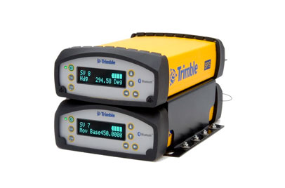
SPS855 Receiver
The Trimble SPS855 GNSS Modular Receiver provides the capability for monitoring tidal and other water level changes in real-time, providing a more precise and cost-effective solution than conventional methods. Tide gauges and associated radio links are no longer essential.
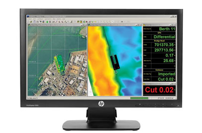
Hydropro Software
HYDROpro™ and Trimble marine construction receivers offer the ideal solution for improving efficiency of wet construction projects by allowing the operator to “see” what’s going on beneath the machine or vessel. Material placement and dredging can be done much faster and with better accuracy than ever before, while reducing the rework that is often required with traditional marine construction methods.
APPLICATIONS
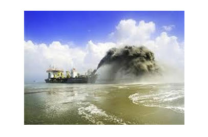
Dredging
No matter what your dredging project, avoid the costly mistake of over or under dredging - thanks to Trimble dredging solutions. Highly accurate dredging can be difficult, because seabeds and riverbeds are obscured from view. Trimble solves your problem with accurate remote positioning you can trust.Integrate your entire onboard navigation system with Trimble. You get a 3D position of the dredge head, which is then displayed with the channel design. So you can see exactly how much earth you're moving even under water. Dredge with confidence using Trimble dredging solutions.
Sandpiper Dredging uses Trimble HYDROpro to Help Replenish Sorrento Beach in Australia
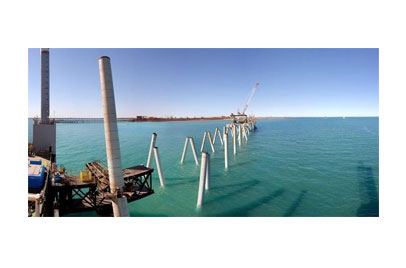
Piling
Driving piles into a riverbed or seabed requires great accuracy in a harsh environment. Trimble utilizes RTK GPS, heading sensors and specialized integrated software to create positioning solutions-designed specifically for marine construction.
Bath iron works

Towing & Rig positioning
Towing and positioning drilling and production rigs in a marine environment is extremely difficult. Your ability to position the structure can be compromised by everything from sea conditions to working at night or in the fog. The need for sub meter accuracy and precise heading alignment in this often harsh offshore environment provides a further challenge.
A major part of the rig move process is the communication with anchor handling vessels to ensure that anchors are moved and laid correctly. Trimble simplifies these complex processes, creating solutions that offer accurate positioning and present data in easy to interpret displays.