UAV Model UX11
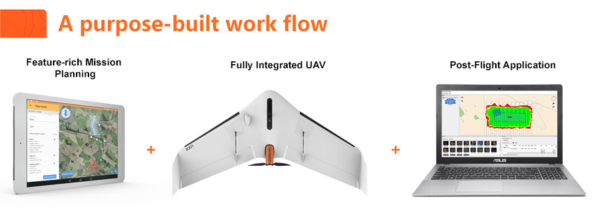
The UX11 is an ideal solution for highly precise and safe mapping in a number of industries such as surveying, construction, oil & gas, utilities, mining, agriculture and transportation. It delivers integrated features for before, during and after flight operations, including an embedded global shutter camera, intuitive analytics and data reporting tools, post processed kinematic (PPK) capabilities for high quality results, and both 2.4 GhZ wireless and 3G/4G cellular connectivity. The drone’s end-to-end system, combined with its operational performance benefits (allowing flights of up to 59 minutes covering over 500 acres at 400 feet), significantly lower the total cost of ownership compared to other surveying and mapping options.
|
Embedded Aerial Intelligence |
Embedded Sytem with Onbaord Processor |
|
|