Trimble UAS
Trimble prides itself on being a leader in innovation. By setting new industry standards to improve our users’ efficiencies and deliverables, we are proud to provide even more breadth and depth to our portfolio by offering the first, and only, complete aerial imaging solution specifically designed for surveyors and geospatial professionals.
UX5 HP
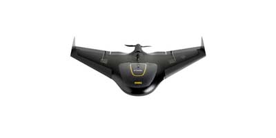
High Performance Trimble GNSS receiver with PPK technology
36 MP, full-frame, high resolution camera
Orthomosaics resolution down to 1 cm & 3D models with up to 1,000 pts/m2
Survey quality accuracy without ground control
Fully automated Trimble Access workflows for ease of -use and safe operation
Simple data processing with Trimble Business Center photogrammetry module
Advanced data processing with Trimble Inpho UASMaster
ZX5
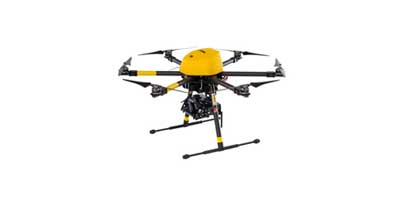
Vertical takeoff and landing for work in tight places and obstructed environments
Everything you need to capture high quality georeferenced photos for applications such as aerial mapping and inspections
24 MP camera
Light, compact,foldable carbon design
Up to 20 minutes of flight time
Can be equipped to capture live video imagery for inspection application
Easy data processing in Trimble Business Center Photogrammetry Module or Trimble UASMaster